
Image produced from the Ordnance Survey Get-
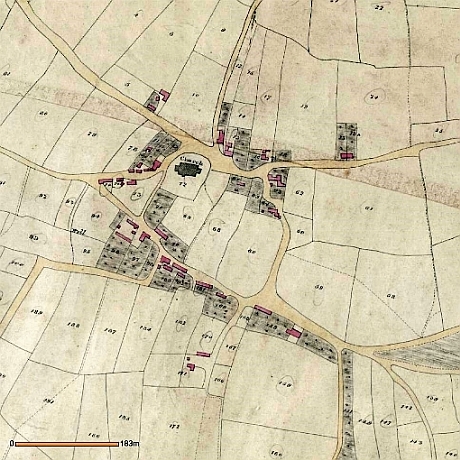
Image reproduced with the kind permission of the Senior Archivist of the Cheshire and Chester Archives and Local Studies. Grid Ref SJ 758867, tithe map reference EDT 59/2.
URL http://maps.cheshire.gov.uk/tithemaps/TwinMaps.aspx?township=EDT_59-
1838 tithe map of the centre of Bowdon village. The original parish church is shown in a dark grey just above the centre
Current (2009) Ordnance Survey map of the centre of Bowdon at a similar scale to the tithe map on the left.